|
|||||||||||||||||||||||||||||||||||||||||||||||||||||||||||||||||||||||||||||
 |
|||||||||||||||||||||||||||||||||||||||||||||||||||||||||||||||||||||||||||||
|
|
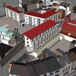
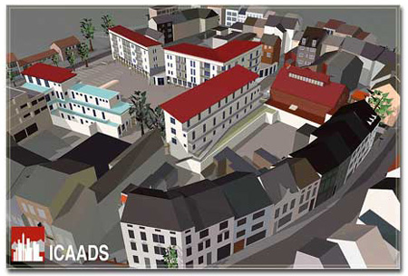
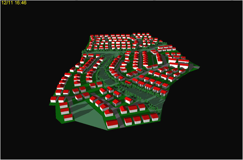
ICA-TownSoftware / Products / CAD-Applications / Town planningWith ICA-TOWN, 3D models, 2D drawings and all possible constructions for town planning projects can be created. It is a tool which simplifies projects and lets the user work very effectively, from design to implementation.
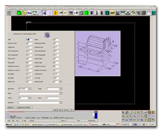
 This module contains a 2D and 3D object generator with a complete library of building components such as building blocks, foundations, walls, doors, windows, columns, staircases, roofs, steel sections, beams, etc. All objects can be adjusted by the user.
 During the construction of a 3D model, plans, sections and elevations can automatically be generated. The model can be presented in orthogonal projection or in a perspective view.
The user also has access to all relevant non-graphical data of the building process. All quantities and descriptions can be extracted with the ICA-Extract module. ICA-TOWN provides the user with a full 2D/3D parametric object modeler for fast and easy project handling. The software comes with an extensive library with typical town planning objects. All the objects can be adapted to specific needs.
The definition of 3D details with user-definable properties and dependencies provides the user with intelligent objects which let him manage the relevant data in any external database.
The modelling of large and complex terrain models likewise belongs to the possibilities.
With ICA-TOWN you can use scanned drawings and/or (aerial) photographs as underlay to visualize town centre renewals.
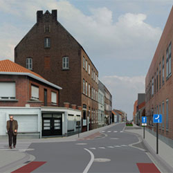
ICA-TOWN comes with a visualization and animation program that allows the user to consider his models 'live' from different points of view while working on his project.
With the help of the very effective Raytracing procedure, photorealistic models can be generated at any time.
 The software offers you the possibility to present your project in the existing surrounding area. As positions of the sun can automatically be calculated on the basis of date, place and time, shadows can be simulated.
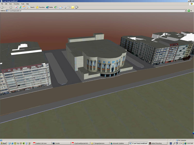 After the visualization, your 3D-projects can be published on the internet in VRML format.
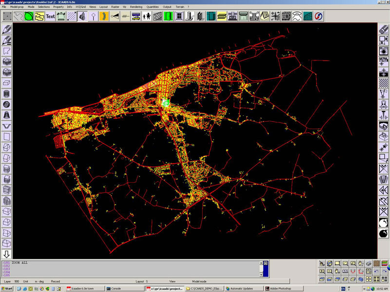 All interfaces (DXF, DWG, SQD, EDBS, ArcXML, AEP, ESRI-SHP) offer a link with the most common CAD and GIS packages and likewise enable you to use all external data and to publish all your plans and drawings on the intranet or internet.
|
|||||||||||||||||||||||||||||||||||||||||||||||||||||||||||||||||||||||||||
Graphicomp nv - Krommewege 31B - B-9990 Maldegem - T. 32(0)50/71 93 28 - F. 32(0)50/71 54 19 - info@graphicomp.com |
|||||||||||||||||||||||||||||||||||||||||||||||||||||||||||||||||||||||||||||
Graphicomp nv - c/o debelux-Handelskammer - Friedrichstrasse 42-44 - D-50676 Köln - T. 49(0)221 139 02 95 - F. 49(0)221 139 02 96 |
|||||||||||||||||||||||||||||||||||||||||||||||||||||||||||||||||||||||||||||